CenterPort
![]()
|
CenterPort
|
|
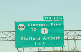
C E N T E R P O R T - 51 Acres Zoned Urban Commercial, with Proffers
- First large tract from Exit of new I-95 Interchange - At Gateway to large mixed-use project NOTE: Stafford County adopted a new Comprehensive Plan, December, 2010 which included new Urban Development Areas "UDA". The Subject tract is presently zoned for intensive development AND is within the new UDA, and is bordered by a tract presently zoned for 600+ du. Details are found near the bottom of this page.
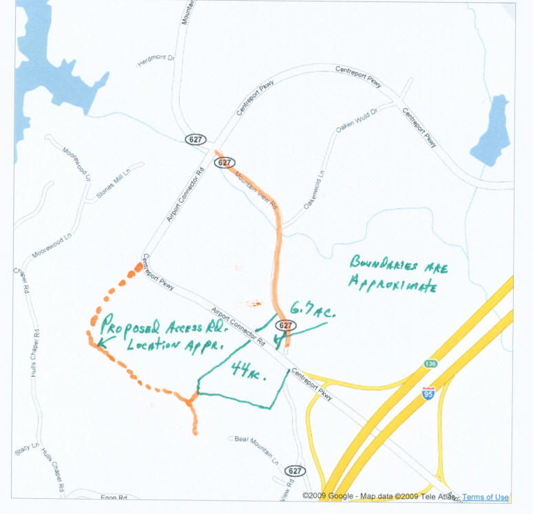
PRICE 51 Acres .............................. $1,290,000 Below, double click to view and/or print map; Note: boundaries are approximate.
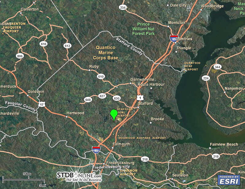
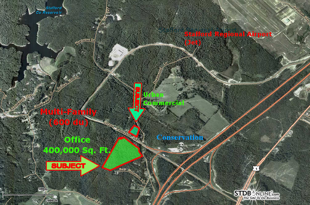
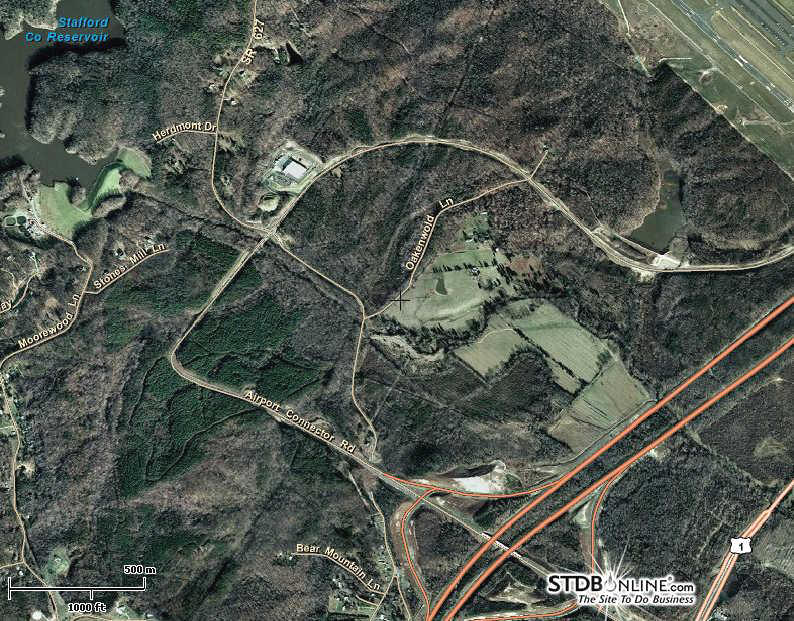
Subject is two parcels dissected by Centerport Parkway. Land use dominating the NEIGHBORHOOD:
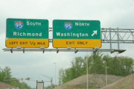
The interchange has sufficient rights of way to become a cloverleaf (need VDOT confirmation); These resources are the both the greatest and lest utilized transportation resources in the region (great capacity)
___________________________________________________________ Click HERE for plat of survey of Subject Tract __________________________________ Geographic Information Systems ("GIS") Maps
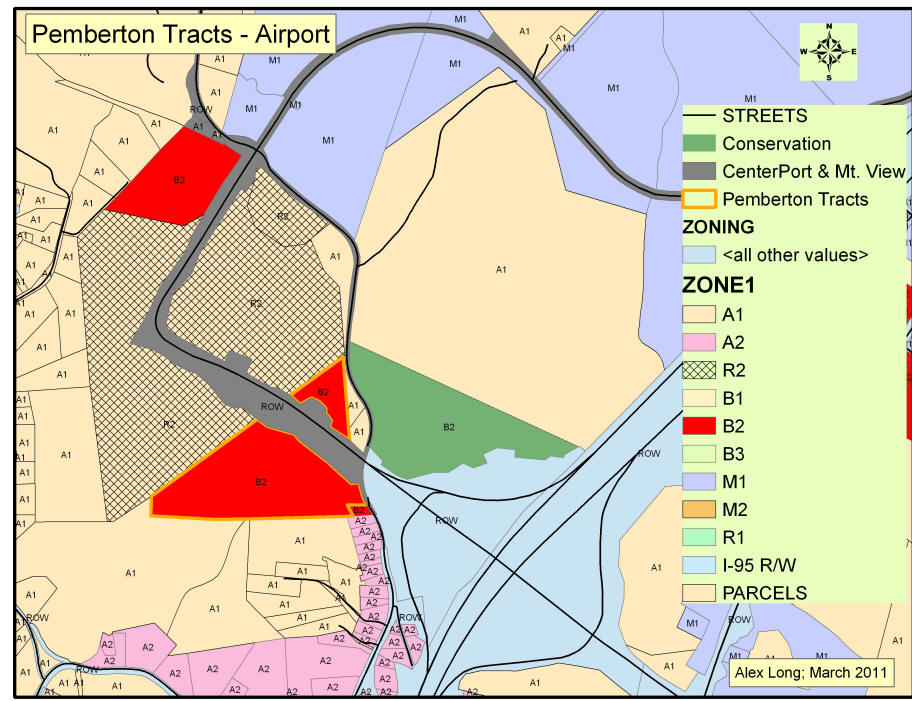
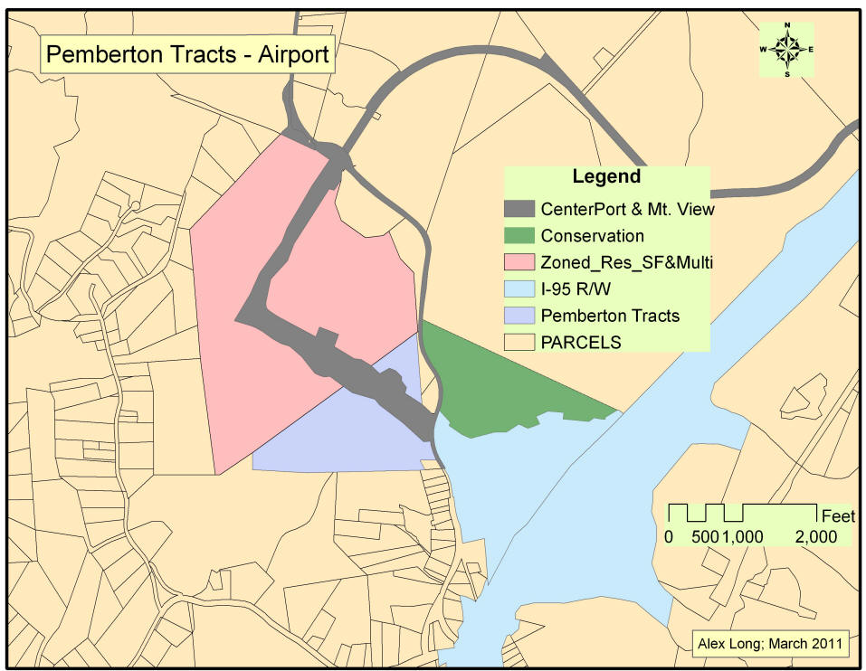
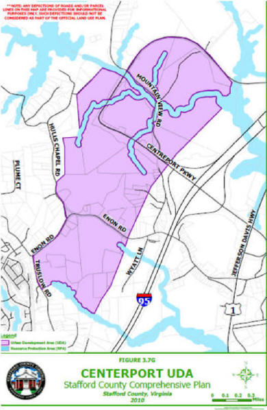
Below, Zoning Map illustrates both the Subject Tract and the CONTEXT of the Subject Tract, what the other parcels are zoned today. Please note that Subject Tract and its immediate area have been designated as an Urban Development Area in the Stafford County Comprehensive Plan.
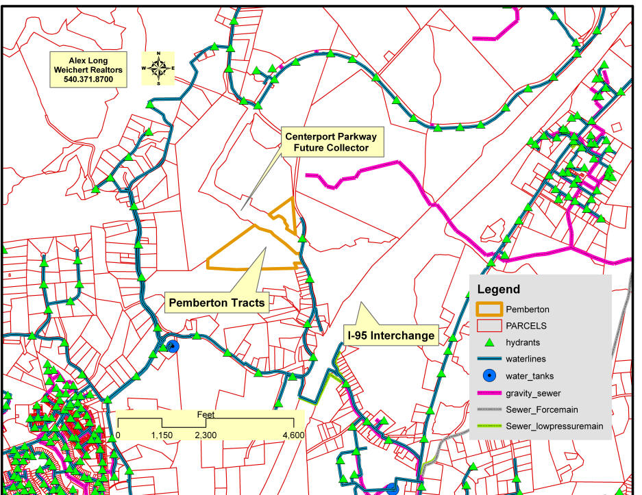
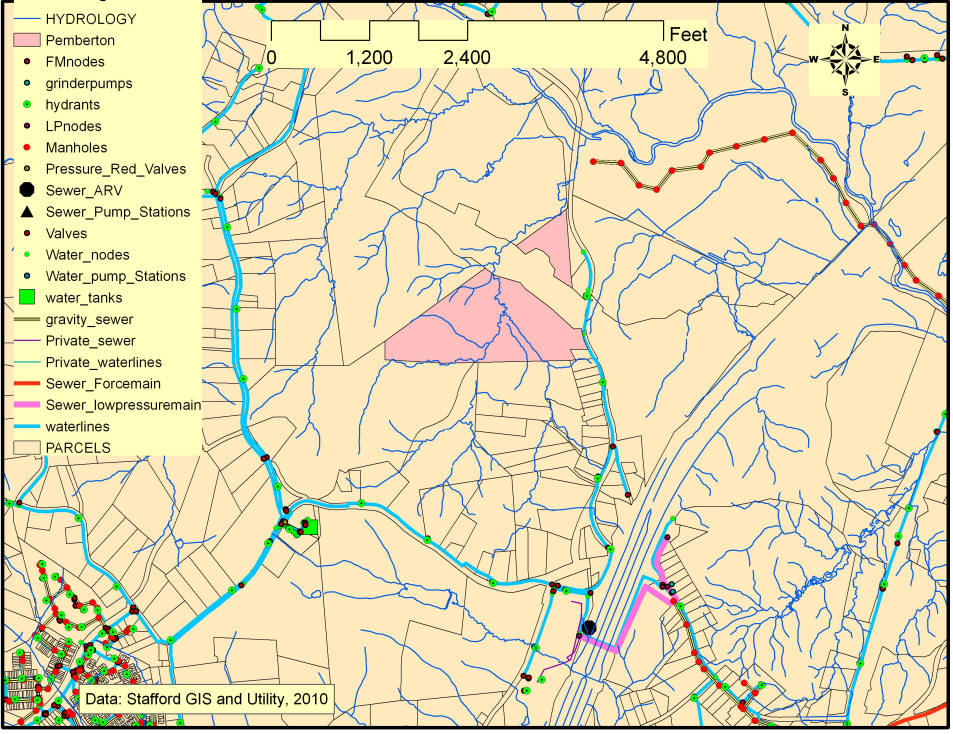
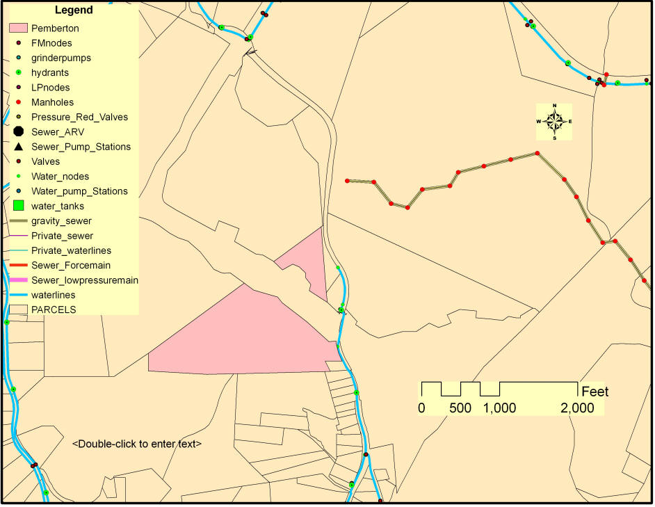
Below, Stafford County Utility Diagram; all is approximate.
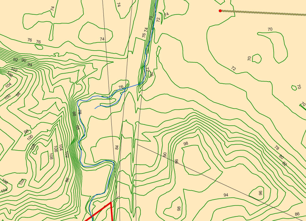
Below, Mid level perspective - Utilities; Below, Micro view to gauge Elevations from existing sewer manhole to Subject Tract
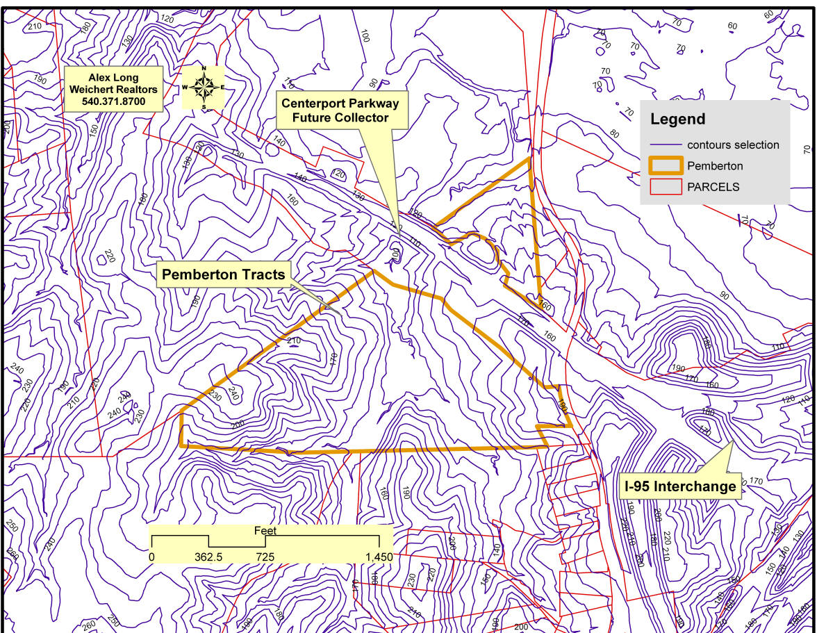
Below, Topography; it should be noted that half the property must be open space.
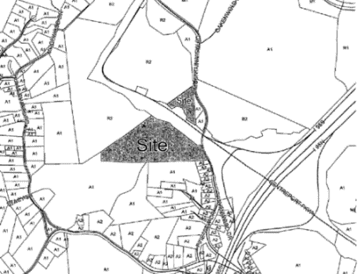
Below, a Stafford County Tax Map NOTE: the parcel designated as "B2, contiguous to the interchange and Interstate 95 is under a conservation easement and was given to the Northern Virginia Land Trust and will not be built upon.
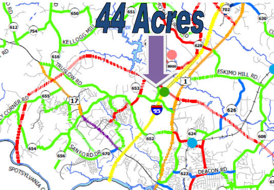
PLEASE NOTE: Centerport Parkway is a "Limited Access Highway"; there can be no road-cuts; Access to the 44 acre tract is per the proffer of building a new access road and traffic light; Access to the 6.7 acres is via Mountain View Road;
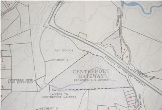
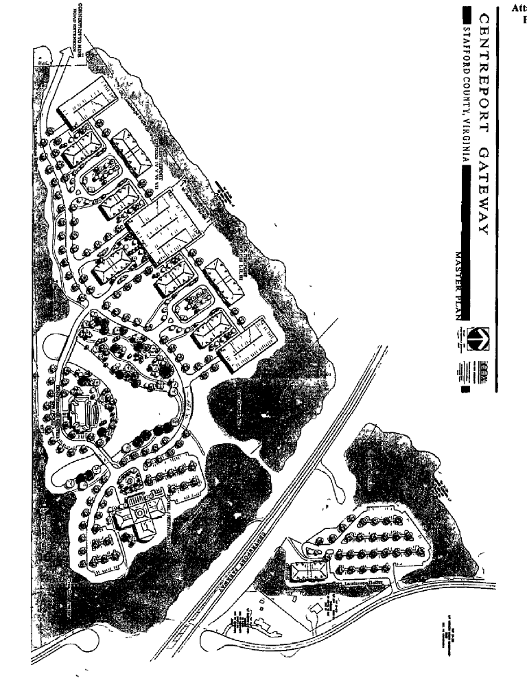
Below, is an Exhibit for the Rezoning to Urban Commercial, showing the approximate location of the proposed Access Road, called the "Mine Road Extension".
Above, double click for GDP;
_____________________________________________ Click HERE for Proffers ____________________________________________
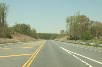
_____________________________________________ The Competitive Advantage _____________________________________ No Congestion New Airport New Interchange New Parkway No Lines A Clean Slate A Fresh Approach A Blank Canvas Your Design - Your Solutions
It is what is not shown in this picture that is MOST IMPORTANT Rights of Way to expand this to a full clover-leaf interchange and make Centerport Parkway a four lane divided highway WHY ?
Below, an excerpt from the 2010 Stafford Comprehensive Plan (Draft, August 2010). The 44 acres and 7 acres are at the "Airport Interchange", which would become the interchange with I-95 for the "Outer Connector". Moving traffic from Route 17 to a connection with I-95, North, is a priority. Major New Road Planned
Click HERE for a copy of the Free Lance Star news article about the proposed Road. Click HERE for an annotated copy of the document, above. ____________________________________________________________________ Intermodal Hub - I-95, Airport; Rail The I-95 Interchange was built as an 'intermodal transportation' resource; linking the Airport, I-95, and VRE Rail. Another feature was the future linkage to the 'outer connector' or beltway around the Fredericksburg Region. Thus, the existing interchange is a diamond but the rights of way are in place to convert the interchange to a full cloverleaf.
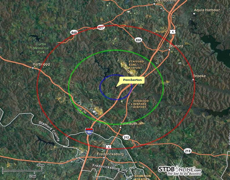
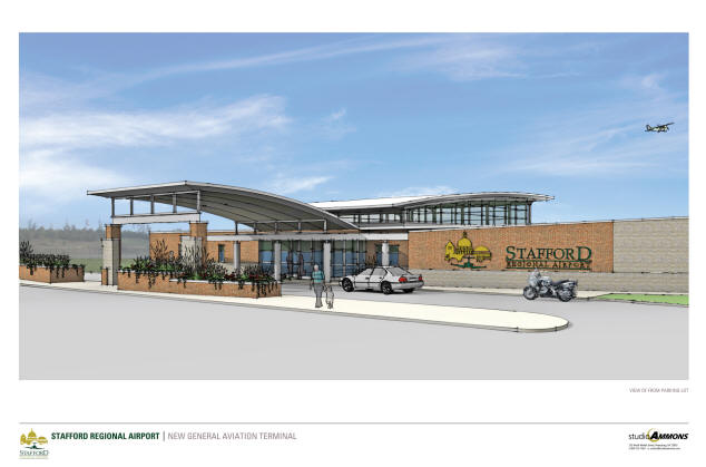
Stafford Regional Airport (Jet-Port) Designed to maximize the safe and efficient movement of aircraft, the Stafford Regional Airport facility includes a 5000-foot by 100-foot instrument runway with full parallel taxiways, Jet-A and Av-Gas fuel storage facilities, and 25 acres of paved aircraft parking aprons.
The 550-acre facilities can accommodate 75,000 annual operations and 100 based aircraft, including corporate business jets, with gross weights up to 70,000 pounds and wing spans up to 80 feet. An additional 25 acres of rough-graded finished lots are available for lease development of individual, corporate and T-hangar aircraft storage buildings and other aviation related business facilities. http://www.staffordairport.com/ __________________________________________________
A look at planned Stafford airport
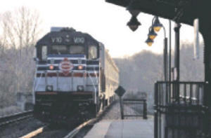
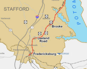
terminal Rail is another transportation option. The Subject tract is near the Leeland Road Station of Virginia Rail Express "VRE". The Airport I-95 interchange was built as an 'intermodal transportation hub.
_____________________________________________ Demographics
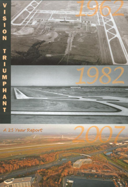
Click HERE for PDF of Demographic Report ________________________________________________________ ___________________________________________________ Although there are many differences between Centerport and Dulles; there are also commonalities: both were rural and grew in economic stature and both share vision. The Stafford Regional Airport (jet-port) is the designated reliever airport to both Dulles and Regan National. Below, cover of "Washington Airports Task Force, 25th Anniversary"; 2007. V I S I O N T R I U M P H A N T
_________________________________________________________________ Only about five miles south of the new Stafford Regional Hospital, shown below
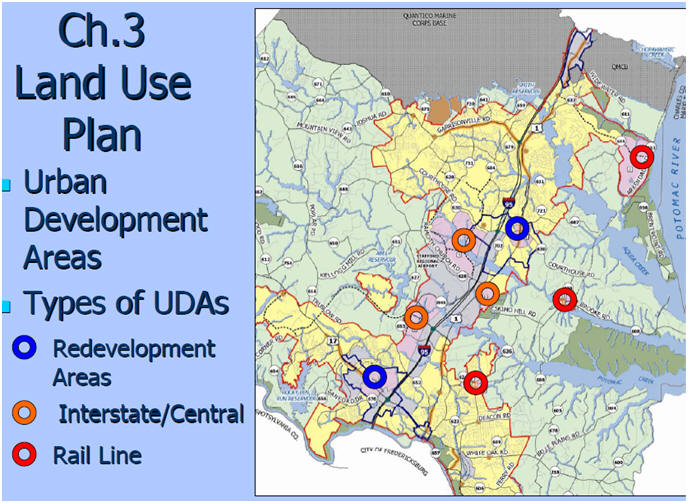
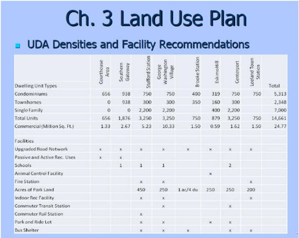
_________________________________________________________________________________ UDA Urban Development Areas
Above, taken from Stafford County Board o f Supervisors PowerPoint; note the UDA at Widewater was not adopted. Retrieved January, 2011.
Notice: Purchaser is cautioned and urged to investigate any and all information and circumstances. Information contained in this web site and links is not guaranteed in terms of accuracy and/or scope. Mr. Alex Long, CCIM, AICP, ALC along@ccim.net 540.371.8700 Licensed in Virginia "CCIM" Certified Commercial Investment Member; "AICP" American Institute of Certified Planners, American Planning Association; "ALC" Accredited Land Consultant, Realtor Land Institute. Weichert Realtors; 1955 Jefferson Davis Highway, Suite 201; Fredericksburg, VA. 22401
|